ARCHAEOLOGICAL METHODS
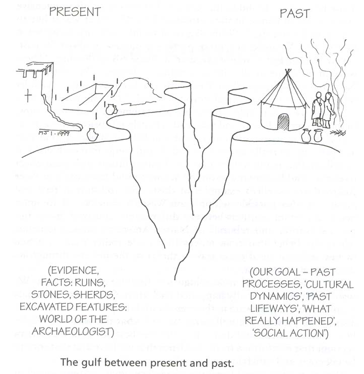
Gulf between present & past
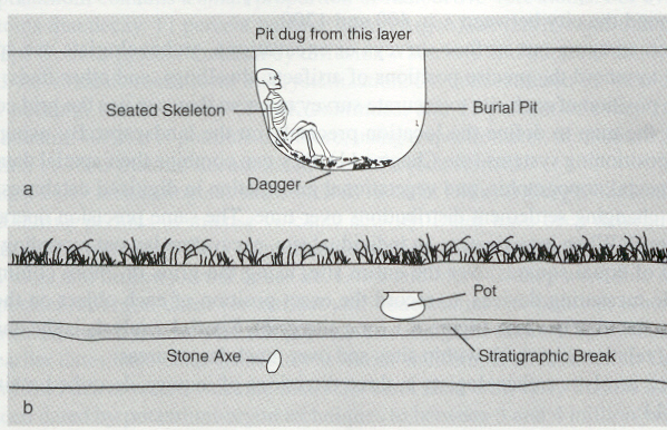
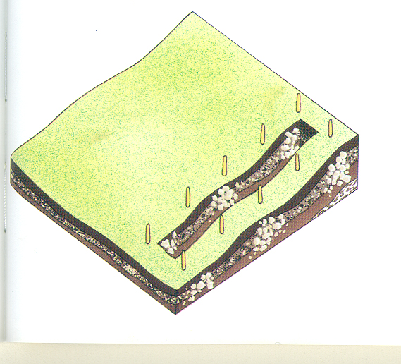
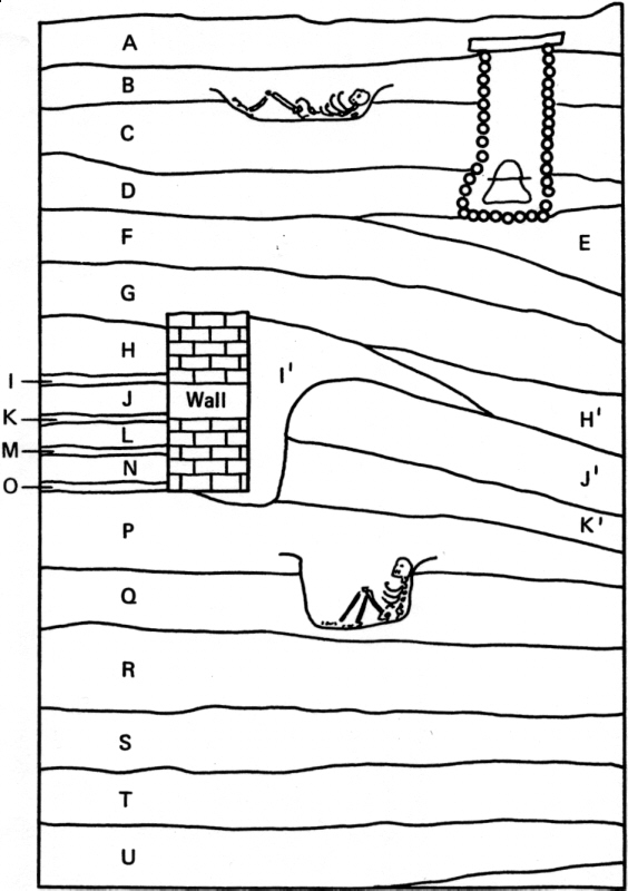
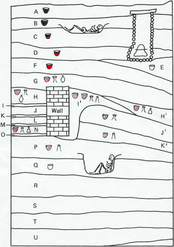
Stratigraphy
Diagram illustrating law of superposition
Stratigraphy at edge of excavation trench
Example of stratigraphy pattern at Abu Hureyra (Trench B)
Key to interpreting pattern
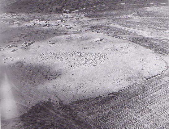
Tells
Example of
tell
(Abu Hureyra)
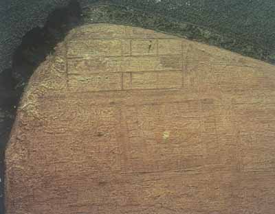
Aerial photograph of
tell
(Tell Beydar, Syria)
Diagrams showing
tell
formation
Tell
formation at Abu Hureyra
Diagram A
Diagram B
Absolute chronology
Graph illustrating the relationship between how much Carbon 14 is left in a sample & how old it is
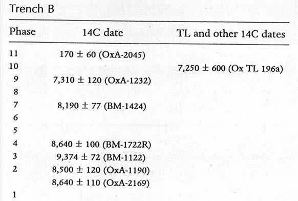
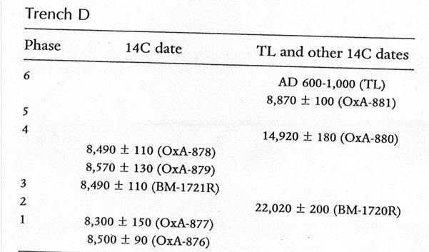
Radiocarbon & thermoluminescence dates for Abu Hureyra
Trench B
Trench D
Application of law of association
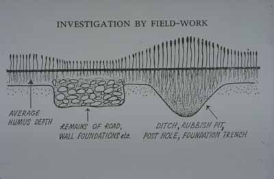
Archaeological survey
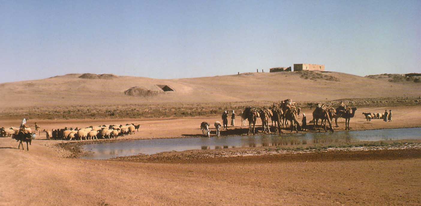
Photograph showing inspection of mound at Abu Hureyra
Aerial photograph of Abu Hureyra
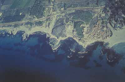
Aerial photograph of underwater remains off the coast of Israel
Crop marks (1)
: diagram illustrating effect of sub-surface archaeological features on crop growth
Crop marks (2)
: aerial photograph of crop-marks revealing Roman military camp
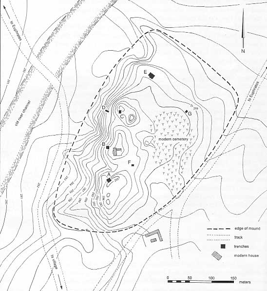
Contour plan of the mound of Abu Hureyra
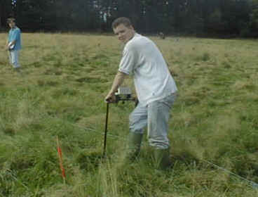
Resistivity survey meter
Use of meter in the field
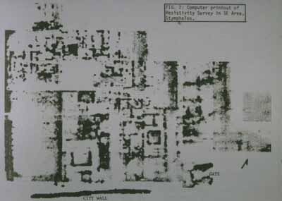
Results of resistivity survey
, showing outline of underlying structures
Excavation
Vertical excavation
Horizontal or Open Area excavation
Grid or Box excavation
Excavation by Mortimer Wheeler using grid method
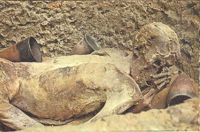
Law of association, illustrated by Predynastic Egyptian pit grave
Step trench (1)
: view from top of mound (Tell Hamoukar, Syria)
Step trench (2)
: view from below (Tell Hamoukar, Syria)
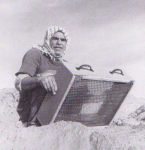
Recovery of artifacts & remains from Abu Hureyra
Sieving soil
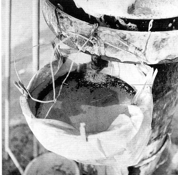
Flotation system
Filling flotation tank with water
Pouring soil into flotation tank
Plant remains collecting in sieve
Sutton Hoo excavations
Sutton Hoo Society
Current Archaeology: Sutton Hoo
Gettysburg College website
Dig exercise
Diagram
Annotated Diagram